


 Cymraeg
This is a slightly altered and extended version of the Day of Archaeology post I wrote a little while ago; you can see the original post on the Day of Archaeology website.
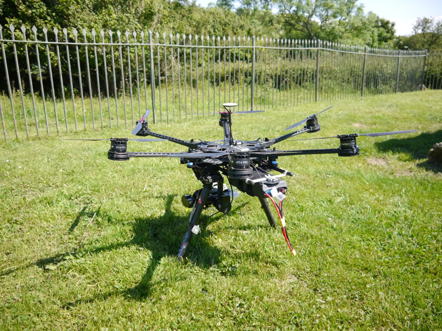
The hexacopter we are using on the HeritageTogether project.
Hi, I’m Helen. I’m actually a computer scientist rather than an archaeologist, working on a project called `HeritageTogether’, which is all about creating 3D models of prehistoric sites in Wales. The project is run jointly between archaeologists and computer scientists at Bangor, Aberystwyth and Manchester Metropolitan Universities – I work as a researcher in Aber.
We are making the models using photographs of the site and a process called photogrammetry which matches up the features in photographs and can automatically create the model. While the project is mainly based on photographs contributed by the general public, we sometimes go out to survey some sites ourselves.
To help with our surveying, we have an Unmanned Aerial Vehicle (UAV) – a remotely controlled flying vehicle that carries a camera; a hexacopter (it has six rotors) to be specific.
Today, Andrew, Joe, Jonathan and I were visiting two sites on Anglesey in North Wales – the Lligwy burial chamber and Din Lligwy settlement near Moelfre. Two beautiful sites which are well worth visiting.
loading map - please wait...
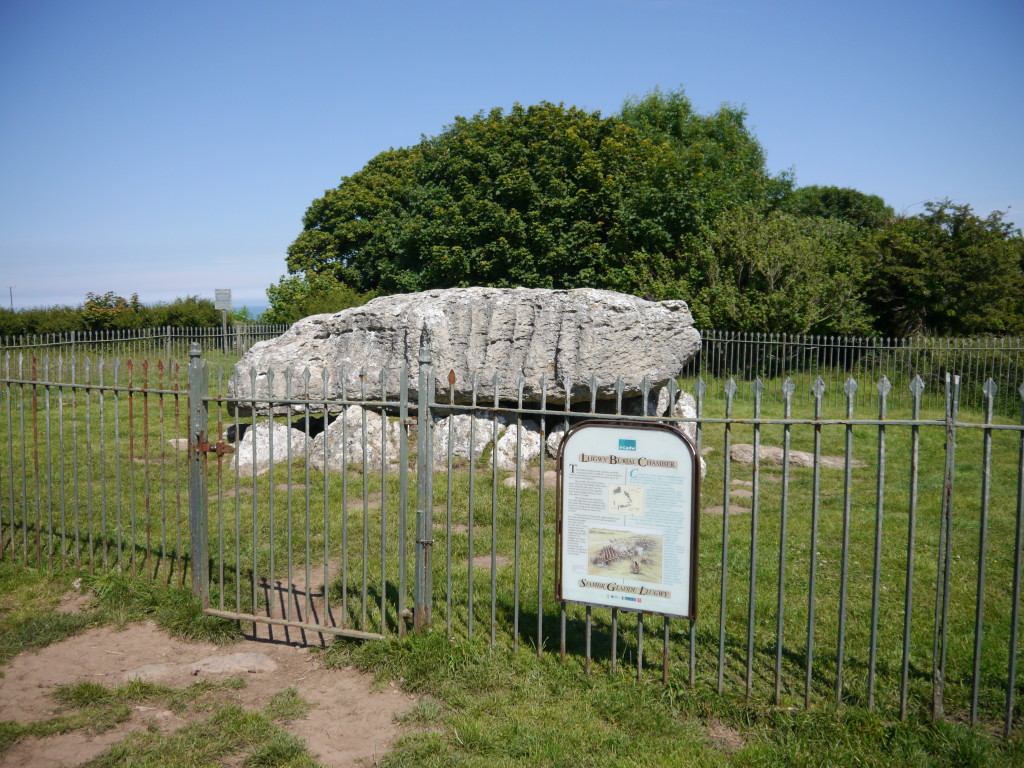
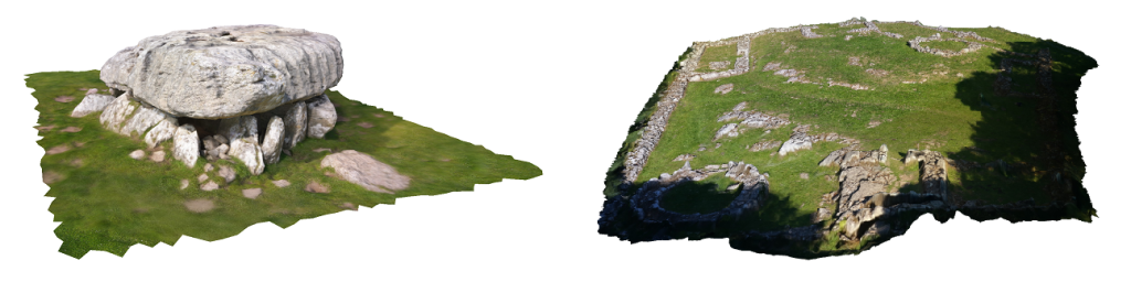
Lligwy burial chamber was the first site we visited. It is a Neolithic tomb made up of eight upright stones supporting a huge capstone which is estimated to weigh at least 25 tonnes.
Lligwy Burial Chamber
Moelfre, Isle of Anglesey
Read more about this site:
Cadw (SAM: AN009)
Coflein (NPRN: 95532)
We flew the hexacopter above the burial chamber, getting a number of photos of the top of the capstone. Once we had done some aerial photography, we landed and photographed the site on foot.
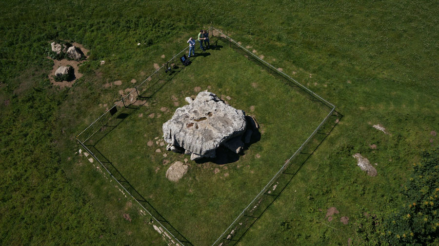
Lligwy Burial Chamber from above!
Lligwy Burial Chamber is now in our gallery:
See the photographs →
See the 3D model →
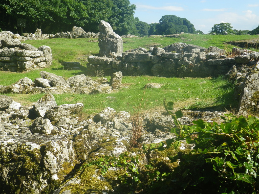
After we had finished photographing the burial chamber we went a little further down the road to reach the Din Lligwy settlement. The settlement is a group of circular and rectangular building from the Romano-British period, enclosed in a large outer wall.
Din Lligwy Settlement
Moelfre, Isle of Anglesey
Read more about this site:
Cadw (SAM: AN023)
Coflein (NPRN: 95532)
We flew above the site, first taking photographs then also capturing a video. We then took a large number of ground shots of the complex site.
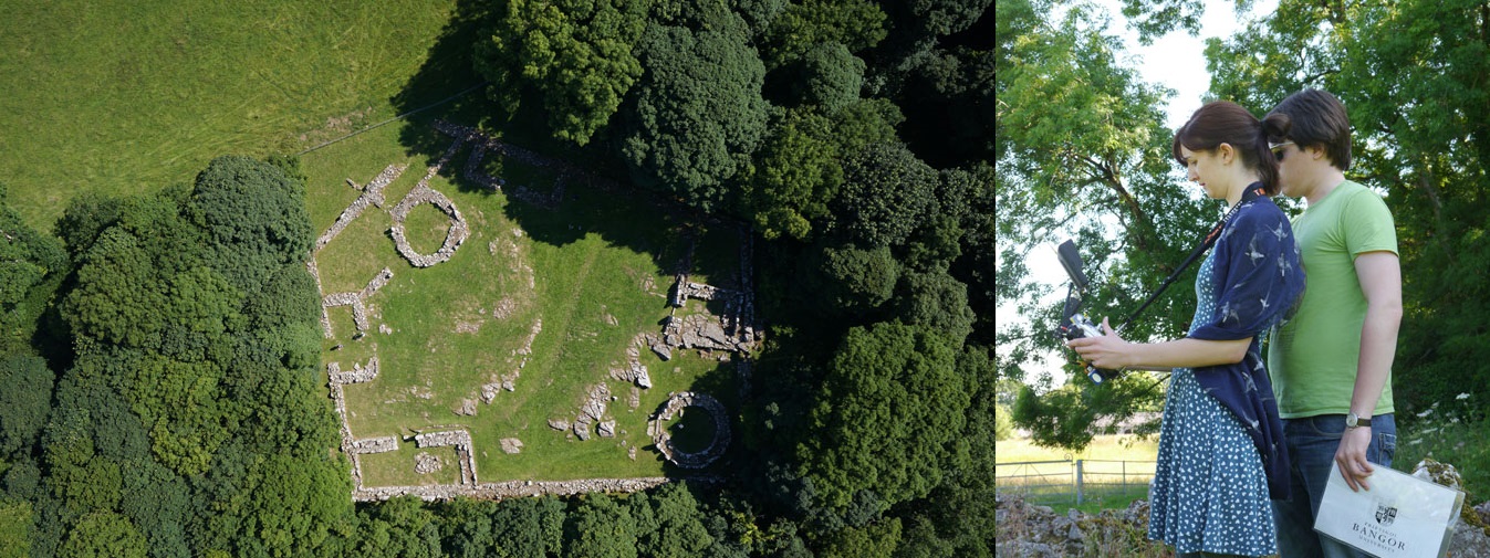
Din Lligwy from above; Joe and I flying the hexacopter.
Din Lligwy Settlement is now in our gallery:
See the photographs →
See the 3D model →
So here are pictures of the two models we made from the surveys:
Finally, here is the rather fantastic bit of video we managed to capture from above the Din Lligwy Settlement (all cut and tidied up by Andrew) – enjoy!